The Atlas of the territories of Italian wine, the work that introduces an absolute novelty – the Macroareas of wine – has been presented yesterday in Rome. Many were the authorities present at the launch of the Atlas: Fabio Carlesi, Secretary–General of Enoteca Italiana, Nunzia De Girolamo, Minister of Agriculture, Food and Forestry, and Roberto Formigoni, president of the Agriculture Committee of the Senate.
The work consists of two volumes and is promoted by the Ministry in collaboration with Enoteca Italiana, it represents an innovative tool for the Italian wine world, a point of reference for producers, scholars, Administrations, and also for all wine lovers. Moreover, it testifies the complex identity and the rich value of all the territories of wine.
Atlas of the territories of Italian wine: a journey in the Italy of wine
A work that leads into a fascinating journey in the Italy of wine through a cartographic apparatus of high value, with historical, economic and legislative references. All this and much more: it is divided into macroareas. The volume highlights the geographical, geological, soil and climate features of specific places that, together, contribute to the uniqueness of a specific wine in a certain place.
The Atlas has been promoted by the Ministry in collaboration with the wines institution.
Composed of 20 regional chapters, organized around 92 macroareas, the work has a dual role: scientific and commercial, for the support that it gives to wine promotion, key product for the Italian economy.
The Atlas: the culture of Italian wine
“We have to make the recent history of Italian wine a parable for the Country and for politics. – the Minister said – We started from the methanol scandal, which made us reach the bottom with serious consequences both in terms of cost and image, but we were able to overturn the data, to change the situation until we made wine become an absolute excellence of Made in Italy, and I am certain that this Atlas will have a great success”.
Roberto Formigoni, President of the Agriculture Committee of the Senate, spoke at the presentation emphasizing the fact that the work is “fundamental, interesting and complete. It is an extraordinary work, useful also in view of Expo 2015”, and highlighting the need “to increase awareness of the cultural value of Italian wines”.
After him, there was an excellent talk by Professor Luigi Moio of the Federico II University of Naples, a member of the Scientific Committee, who explained to journalists and operators the technical sections of the volumes.
“It is a revolutionary work, innovative and courageous, – Carlesi explains with satisfaction – able to represent the Italy of wine in several aspects”.
The Atlas of the territories of Italian wine
Two volumes, 864 pages (1st volume: 384 pages – 2nd volume: 480 pages)
Its areas are 5:
a) Maps and images by the Military Geographical Institute. 227 cards in total, of which: 20 regional perspective, 20 regional introductory, 140 for the 92 areas identified, 47 DOCG areas. Twenty-nine ”orthophotos” (geo–referenced aerial photographs)
b) Maps, tables and sheets on soil features by the Agrobiology and Pedology Research Centre of Florence. 232 cards in total, of which: 20 regional on the lands cultivated with vines, 92 of the macro areas, 120 on the climatic conditions (6 for each region). 129 are the tables relating to the characteristics of some soils. Twenty are the cards on the soil features representative of a specific region.
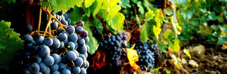
c) 317 photos of landscapes and vineyards.
d) Economic tables relating to the production systems of each single region and of the 33 macroareas chosen.
e) Tables relating on DOP and IGP.
© RIPRODUZIONE RISERVATA
30/10/2013